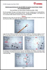
User Manual for the Navigation hand-plotter
Here you will learn step by step how to use the navigation hand-plotter in practice using 5 examples


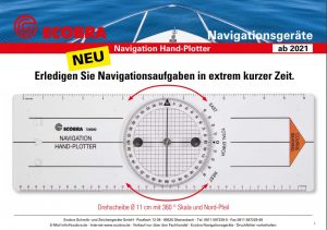
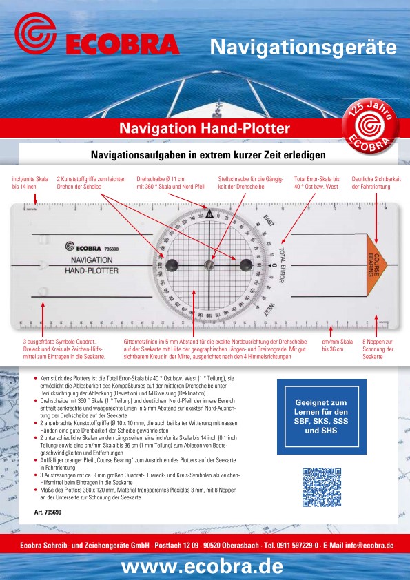
Navigation hand plotter
Complete navigation tasks in an extremely short time
– The heart of the plotter is the total error scale up to 40 ° east or west (1 ° division), it enables the compass course to be read on the central turntable, taking into account the deviation and declination
– Turntable with 360 ° scale (1 ° division) and a clear north arrow; the inner area contains vertical and horizontal lines 5 mm apart from the exact north orientation of the turntable on the nautical chart
– 2 attached plastic handles (Ø 10 x 10 mm), which ensure that the disc can be rotated easily even in cold weather with wet hands
– 2 different scales on the long sides, an inch / units scale up to 14 inches (0.1 inch graduation) and a cm / mm scale up to 36 cm (1 mm graduation) for reading boat speeds and distances
– Noticeable orange arrow „Course Bearing“ for aligning the plotter on the nautical chart in the direction of travel
– 3 cutouts with approx. 9 mm square, triangle and circle symbols as a drawing aid when entering into the nautical chart
– Dimensions of the plotter 380 x 120 mm, material transparent Plexiglass 3 mm, with 8 knobs on the bottom to protect the nautical chart
Suitable for learning for the SBF, SKS, SSS and SHS
Ref. 705690 EAN 4011123664303
Picture 1: Description of all functional parts of the plotter
Picture 2: Above (from left): turntable Ø 11 cm with 360 ° scale and north arrow. Adjustment screw for the smooth running of the turntable. Total error scale up to 40 ° East or West. Below (from left): 2 plastic handles for easy turning of the disc. Grid lines at 5 mm intervals for the exact north alignment of the turntable on the nautical map with the help of the geographical longitude and latitude; with a clearly visible cross in the middle, aligned with the 4 cardinal points.
Picture 3: 3 milled out symbols square, triangle and circle as a drawing aid for entering into the nautical chart
Picture 4: Clear visibility of the direction of travel: COURSE BEARING
Picture 5: 8 knobs to protect the nautical chart
Picture 6: Above: inch / units scale up to 14 inch. Below: cm / mm scale up to 36 cm
Interested in the product?
• As a commercial reseller in our industry, you can buy directly from us using the
contact form.
• As a commercial end user (B2B) or private end user (B2C), you can purchase our products from our trading partners (list of dealers)
Note: Article search on the Internet via Ref. no. or EAN no. possible.
Keywords:
hand plotter, navigation hand plotter, navigation rulers, navigation tools, course rulers, course rulers, nautical equipment
User Manual for the Navigation hand-plotter
Here you will learn step by step how to use the navigation hand-plotter in practice using 5 examples
Short information for the Navigation hand-plotter